Wednesday, June 30, 2010

i climbed a mountain


ok, so maybe i'm exaggerating a little. the ranger did call it a hill. nonetheless, i am proud of myself. we set out today for our own, independent hikes. i for one am a big believer in experiencing wilderness by yourself, though i know that there are also dangers involved. we started off at the twolomne meadow ranger station, and got advice as to which trail to take. he recommended that i take a two mile round trip hike up to gaylor lake, on the easternmost edge of the park. me, i'm thinking, 'well, that's not as long of a hike as i wanted, but it sounds like the views will be neat.' so mum dropped me off. what i failed to note about this 'moderately strenuous' hike, was that it gained 500 feet, and then lost 200, in the matter of a mile. and it started at 9945 feet above sea-level. now, this isn't necessarily a problem, but we just came from the coast.

he also warned me that there would be snow: this time of year this meant that pretty much the whole trail was either under running snow melt, snow itself, or ridiculously muddy. so here i am, panting, shoes covered in mud, trying to climb a trail that was essentially all stairs or switchbacks. and loving every minute of it. i got to the top of the mountain, reaching my maximum elevation of 10,445 feet, and looked down at the valley two hundred feet below me. when the ranger said 'there will be snow up there,' he really meant it. most of the lake and surrounding valley were still covered. i later walked across some of the meadow--most of the snow was still at least 2 feet thick. anyway, i climbed down, and actually hiked to what looks in the picture like the furthest part of the lake. it was absolutely beautiful. snow and mountains all around, creeks and rivers swollen with snow melt, and no one in sight. i found myself an impromptu recliner made of the ground and a rock, and sat down to eat my lunch in the middle of the valley. in about a month, this valley will be brimming with wildflowers and animals, but right then i had it all to myself, with the sunshine and the snow. the view to the west is the one at the top of this post. below is a 360 degree video i took from the middle of the meadow, if you are interested.

meanwhile, my mom was taking a hike to parsons lodge and the soda spring, which is a naturally occuring carbonated spring. the lodge is one of the old historic ones that was built back in the day before the park was really protected at all. she also got some great pictures of twolumne meadow, one of john muir's favorite spots in the park. that's it to the right.

after we were both down with our hikes, we headed back out the eastern end of the park, and back to lee vining, where we spent last night and will spend tonight. we both wanted to find out more about this mysterious lake just next to town, which i mentioned in yesterday's post, so we headed to the mono lake national scenic area visitor center. this is under park service control, and i suppose is somewhere in between a recreational area and a national park. anyway, what we learned was quite interesting! the lake used to be much bigger, but in the 40s they started diverting water for los angeles. soon after, a group of locals got together with environmentalists to save the lake. what's so special about this lake? it is one of the oldest lakes on the continent, features volcanoes, loads of birds, a delicate ecosystem, is saltier than the dead sea, and has a ph of 10, which is really quite alkaline.

we decided to go on a tour of the southern end of the lake, famous because it is the largest occurrence of tufas. now what is a tufa, you ask? it's a petrified spring. and how does that happen? the lake, as i said, is very salty and has lots of carbonate it in, and the water that springs up into the lake has lots of calcium. so, you have water bubbling up with calcium, which mixes with the carbonate, forming calcium carbonate--that's limestone. these little pieces of sediment settle around the spring over time, forming these hollow towers. of course, no one knew they were there until the lake level dropped. quite interesting, and one very, very strange but awesome lake. after that we just went to dinner and turned in for the evening--it had been quite a long day.

Tuesday, June 29, 2010

yosemite

this morning we woke up in dublin, ca, just to the east of oakland, and headed east. after a breakfast at ihop. and do i mean east! luckily we were able to stop at a roadside stand in the san joachim valley to buy some delicious blueberries and cherries to fortify us. taking a number of highways, because apparently californians do not believe in east/west roads, we finally made the approach up to yosemite national park. while it was not nearly as bad as yesterday or the day before, this road was literally switchback after switchback as we gained 7000 feet in elevation in practically no time at all. thankfully, we did make it safely to the park. and for the record the entire way there, until we were almost on top of the park, the scenery was much like the picture above, although usually without the lake. i think this lake (name unknown) was caused by a dam, simply because it looks so surreal and out of place in this particular spot. there were a lot of people out on it and for good reason--it was getting above 90 degrees.
the first place we went in yosemite was to the eponymously named village by the falls. of course, this was also where the most pedestrian and auto congestion was. anyway, we stopped for a while to see the falls, taking the picture from a ways away to get most of it in the pic. this waterfall is the highest in north america, falling over 2400 feet. it does do it in two legs--this picture really only captures the top half. i then proceeded to walk to the bottom of the lower falls and climbed some limestone boulders until i was spitting distance from the falls. i sat there for quite a while, until i was practically drenched and freezing to boot, and decided that i didn't want to catch pneumonia.

by the time we were finished looking at the falls it was getting towards late afternoon, and we knew that we still had a two hour drive through the park before reaching our destination: a little town called lee vining on the east side of the park. thankfully, this drive was not particularly twisty, and it was actually quite enjoyable. we saw some more snow, and also such funny things as this icy sign by the side of the road--this being the very end of june. of course, much of the park is between 8000 and 10000 feet, so that helps to explain this phenomenon. at least the roads were open. we also got to take pictures of our first up close giant sequoia tree, which is kind of like a cousin of the coastal redwoods we saw yesterday, and have many characteristics in common. of course, these are not the biggest--those would be in sequoia national monument--and not as big as the redwoods either. nonetheless, they were still impressive.


our next stop on the tioga road through the park, much of which looked like the picture at the bottom of this post, was out olmstead point, where we had fantastic views of the second thing the park is known for--its granite faces. about 8 or so of them are famous enough to be landmarks, including the most famous--el capitan and halfdome. it was fun to get to see so much of it. it's really quite strange: there are these trees which literally seem to be growing out of giant rocks. of course, these rocks weren't always like this. they have been smoothed by both water and glaciers, making many of them easily hikeable today, as you can see.

by the time we left the park, and then the forest around the park, and got to lee vining, it was past 7, and we stopped at a place called nicely's for dinner. then it was on to our bed and breakfast, a nice place called the hess house, just off of main street in lee vining. i'm actually kind of excited to see more of what is immediately around here--its only 6000 feet, so it is certainly warmer, but there is also some sort of strange lake, probably volcanic. tune in tomorrow for more details.

giant


when we left our motel this morning, the excellent curly redwood lodge, our first stop, at what was supposed to be a fantastic lookout, we took the above picture. not very promising, but not to be thwarted by any creepy northern california fog, we pressed on. for our determination we were treated to our first wild hollyhock flowers of the day--we would see a bunch later on, and in quite a few different colors, but these were our first, and even i thought that it was cool to see them in the wild. anyway, we continued to head south on highway 101, which eventually led us through the national and state redwood parks. while we had done this yesterday, i never really got over the fact that we were driving through a redwood forest, giant trees all around--it was truly amazing.we also took a scenic byway that took us to the largest tree in the park--at least diameter wise. it is 64.8 feet around, and so tall it has another tree growing on top of it. no joke. they also estimate that it is 1500-1600 years old. i'm not showing you a picture because you would have no idea that it was any bigger than any of the other redwoods.while we were in a trail network we headed town the cathedral trail, which i thought sounded promising. and what a cathedral--a lot of our pictures came from this area. i chose to include pictures with people in them to give you some scope. when you just see these trees from a distance, it looks much like any other forest. but walk among them and it feels like you are walking through the set of jurassic park. for not only are the trees giant, as you can see, but so is everything else. this picture of me with some ferns is me standing in the ferns, not sitting. they were as tall as me. we also saw rhododendron plants that were easily 10 feet tall, for those of you who know anything about plants.

of course, the trees dwarf everything else. these trees only grow out of each other, so they are called mother/daughter trees--they don't propagate by seed like other trees. their bark is naturally flame-retardant, so they can't burn down. and their bark is silvery with vertical stripes--it is the wood inside that gave the tree its name. and just when you think you've seen it all on one of these trails, you see something like this: a giant uprooted tree. and then you realize that it is a root system this small that supports a 200+ foot tree. crazy.


after a short walk, we headed further south, and walked the lady bird grove loop hike, where we also ate lunch. interestingly, this national park was not designated as such until the 1960s, and it was in this grove in the heart of the park that it was dedicated. after lunch it was several hours of twisty roads leading south to the coast road, highway 1, long considered one of the great american drives. i'm talking harrowing, 15 mph turns, through speckled lighting. but it was still beautiful driving, with more than the occasional redwood. and i think it was all worth it for those 40 or so miles that we spent driving along the coast. the fog had gone away several hours before, and it was nothing but sun and wind on the mostly rocky northern california coast. we stopped in fort bragg (no relation) for a great authentic italian dinner, thanks to the yelp application for iphone. and then it was more driving--we made it all the way to dublin, which is a little east of oakland in the bay area. thankfully this means that we have only a few more hours to yosemite tomorrow. yay!

Monday, June 28, 2010

blue

we left portland this morning and headed south on us-5. our destination: crater lake national park. we took a scenic drive down towards it, which took us through the rogue-umpqua scenic area. we saw the umpqua river, above, on our way to the lake, and the rogue on the way back. and i have to say it: they dammed the rogue. the umpqua, though it is hard to see in this picture, was a beautiful emerald green because of minerals in it. you can also actually fish for salmon in the river, and a lot of people were. this part of oregon was what i also thought the state would look like--not the desert we had seen up until then. anyway, after a few hours, we had reached the heart of the cascade range and crater lake.

crater lake was the fifth national park ever created, and has been on my must-see list for this trip from pretty much day one. its elevation around the rim is roughly 8000 feet, and the lake is 1000 feet below. it used to be a volcano, but the middle fell in after it ceased being active, forming what is called a caldera. there are no streams or rivers leading to or from the caldera, so the lake is formed entirely from rain and snow melt. it is considered to be the purest water in north america, and even the world. you can see an 8 inch disc 400 feet below the surface, and the lake is about 5 miles in diameter.. this is also the reason it is so blue--the water is so pure that the light is able to penetrate really deep into it, sending back only blue color for our eyes to see. the picture of me was taken around the northern end of the lake.
of course, you have to drive for several miles within the park before you reach the lake. the surrounding area is filled with beautiful tall evergreen trees and....snow. there were still piles of snow reaching well above our heads. there was evidence that people had been snowboarding and snowshoeing. i found out later that the lake receives, on average, 44 feet of snow a year. 44 feet. and much of the lake itself was still covered with ice. i mean, this is late june, people. we could only drive about 1/3 of the way around the lake because the rest of it still needed to be plowed. only 1.5 miles out of 90 miles of trails were open--the rest were still inaccessible because of snow. and to top it off, it had snowed as recently as four days ago. so here we are, in our shorts/tank tops, wearing sandals in the 75 degree weather, walking on snow. that's my feet below; in the picture to the left i pressed myself into a person-sized imprint in the snow by a pull-out. needless to say, i did get snow in my sandals, but it also felt good in the heat. what a strange world.when you first walk up to crater lake, you see the far rim first, then the lake directly below it. which means that you are spending your first few seconds at the lake trying to figure out where the mountains end and the reflections begin. it's a little easier in this picture, but much of the rim was less peaked and more flat-topped. it took me a good while to figure this out. and then you spend several minutes marveling at the color contrasts. the lake, the sky, the snow, the green trees, the bark which matches the stone in the mountains. it really was enough to make blue/green/white/brown my new favorite color combination.

then you begin to notice other things--like how there are creeks of melted snow running beneath existing snow banks. or the island in the middle of the lake--called wizard island, it is a volcanic cone in and of itself. that's it to the left. you can actually hike to the top of it, but you have to take a boat to the island, which of course we could not do this early in the season. you have to wait for late july. and you can swim in the lake too--that would be a fantastic, albeit very cold, picture. there were quite a few people at the park, particularly around the rim village, which i suppose is understandable. i was glad that we had approached from the north, and thus had experienced that less crowded section. anyway, before long it was time for us to hit the road again. again. i could easily have spent hours and hours just staring at the lake--i wish we could have hiked to a viewpoint or down to the lake, but alas, we have not time for everything. i can hesitantly say, though, that this is my favorite national park so far.

as i mentioned before, we passed by the rogue river on our way south from the park, and the drive from here into california was truly stunning. tall trees, filtering sunlight, occasional lakes, rivers, and towns. entering california was like entering a foreign country, literally. they had a station to stop all traffic, and made us eat our cherries on the spot--i suppose that they were afraid we were bringing some sort of cherry disease with us. we would also have had to abandon any citrus, if we had had any. about 20 miles after entering cali, we realized we were on the redwood highway, and for good reason. while it was a hairpin highway, it also passed through several amazing stands of redwoods. so surreal to just be driving in between them. we didn't stop for the redwoods, knowing that we will be going to redwoods national park tomorrow, so we went on to crescent city, where we are spending the night. meanwhile, it is nice to finally be in our most western state. a little more than a week from now i will be heading back east.

Saturday, June 26, 2010

portland

we woke up this morning in portland excited to explore the saturday market. this occupied about three full blocks in the riverfront park and adjoining open plazas, filled with artisan vendors and food trailers. the picture to the left is of the market before it got busy--we got there a little after ten, when it started. needless to say, we easily spent three hours browsing, buying, listening, watching, and eating. this was really the first time that we got a good glimpse of what we would expect a northwest city to be like: unique. we saw everything from roasted nuts to artisan soap, carved food, paintings, leatherwork, and everything in between, including a fair amount if kitsch. we also saw a bunch of interesting performers, including this band, whose cd we bought. they're called 'all the apparatus,' and play a kind of new-age big band music. apparently they are also from hawaii, which i just found out from their website. we bought some great soap from one of the local stalls, and i also got this fun beaded bracelet. for lunch we had great ethnic food--i had a gyro from a greek stall, and mum had perogies from a different trailer. and what good food. we sat on the steps of one of the plazas, surrounded by hundreds of people, half of them wearing pants, sweaters, and turtlenecks. apparently half of portland does not believe in wearing summer clothes--but who am i to judge? anyway, it was a lot of fun. after walking around the market we headed to stumptown coffee, the authentic local portland coffeeshop.i got a fantastic coffee, and we headed up town a little to go to the portland test rose garden, which is world-famous. of course to get there we had to take a tram and then a bus, requiring us to get transportation tickets and figure out how to get there. but, compared to other cities, it wasn't too bad. and i really like the fact that portland has trams and not a subway system--it seems friendlier somehow. after only about 20 minutes, however, we were at the rose garden, which was gigantic, had quite a few people, and was fantastically beautiful. there were so, so, so many different varieties of roses, some of them with names like 'blue yonder' and 'barbara streisand.' big and small, heavily scented and not smelly at all, and colors from white to red to purple and yellow, and everything in between. curly petals, different ways of unfolding, some with buds a different colors, some on vines and some on bushes.we had a great time walking around, sniffing and admiring the roses, as well as watching the various wedding parties that were there. before we knew it, it was getting late, and we needed to head back towards the center of town to go to dinner.

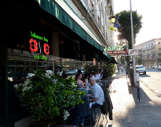
we took the bus out of the park/museum/ nob hill part of town back to 18th street, and walked back to 12th. on the way, somewhere around 14th, we saw this statue on a street corner--some artist's homage to the bicycle culture of portland. we did see a lot of bikers, as well as people just walking around--it is very pedestrian friendly, as far as cities go. for food we went to go to what is universally considered to be the best seafood in town: jake's famous crawfish. now, jake's has been in portland since 1892. no joke. and while it wasn't exactly cheap, it was fantastic. we sat at a bar in the back to not have to wait on a table, and had a funny bartender serve us. i got a fantastic dish of oregon rockfish with washington crab on top, with mashed potatoes and asparagus on the side. dessert was also great--mum got the 'famous' truffle cake, and i had the walnut apple upside down pie with ice cream. needless to say, we were quite full and ready to turn in for the night once we were done.

Friday, June 25, 2010

the beaver state


no joke, oregon is the beaver state. anyway, we woke up this morning in the happy little town of pendleton, pictured above as seen from our bed and breakfast, the riverwalk, which is at the left. our hosts were very hospitable and cooked up delicious blueberry muffins and great conversation to go along with it. interestingly, the building used to be a boarding house--the current owners have been operating their b and b for about 3 years now and really enjoy it.

our breakfast conversation had to be cut short, however, because we were going to tour the pendleton mill at 9, so off we went. as i explained before, pendleton has a special place in the hearts of our family, so we were really anticipating this visit. it was neat to see how these wool fabrics were made and to see the giant spools, which you can see part of to the right. they have these massive looms which can turn out a blanket in minutes, after being hand-threaded, which takes about 24 hours. after they are woven, a little old woman goes over the fabric with a fine-toothed comb, literally, looking for flaws. just her and these giant rolls of fabric. after that, it is usually fluffed, which involved essentially brushing them up into the wool version of an afro. then its cut, finished, etc. of course, we spent too much time and money in the store, but in our defense they had things cheaper there than you can find literally anywhere else.after leaving pendleton, we headed west on highway 84, following the columbia river the 200+ miles to portland, seeing quite of few of windfarms, like that to the left, along the way. the road was really beautiful, just following the river, which was mostly lake after lake built by dam after dam. at several points you can drive on pieces of the old highway 30, one of the first paved roads in the nation. it's on the land side of the new 84, and man, you can tell it is old: it was built in the 30s. the engineer tried to insist on things like having at least a 100 foot turning radius on the corners. the first trek of old 30 we took led us up the side of the gorge wall to rowena crest, which had a breath-taking view of the river, and was filled with stunning wildflowers. now, i'm not a huge flower person, but i do have a soft spot for wild flowers, particularly poppies, and now whatever these blue flowers are in oregon. the picture to the right is of highway 30, the one below of the columbia from the crest.


we stopped at one of the falls and took pictures in one of the fields filled with flowers. there were others too, wild sunflowers, some purple flower as well as poppies, but these blue ones were the most populous. we also stopped at a cherry farm to buy a delicious pound of cherries for the bargain price of $2.00. we got on another part of 30 a little later, which is where we saw the waterfall. this second part of 30 was more crowded than the first, so we tried to stay away from the gaggle of families and groups of teenagers to press on toward portland.
to be honest, i have been really excited about portland since day 1 of this trip. i've always wanted to go to a northwest city, and i've learned about the great city-planning and green trends in this particular one since i was in middle school. we checked into our hotel and wandered around the city a little bit (it was already getting towards late afternoon) by ourselves. mum apparently wandered toward the tradition city center, with the courthouse and large-ish square, where she saw these people having what they called a sit-in, trying to get people to just sit and meditate for a bit on these large pillows. not a definition of a sit-in that i am familiar with, but i appreciate their sentiment. and like many large cities, there was a place for people to play chess--they even had some chessboards carved in stone on these podium things. they also had these really cool statue fountains, each featuring a different animal. when we came by together after dinner of thai food at a place called typhoon, i snapped a picture of the one with seals. although, knowing what i do now, i should have gotten the beavers.

for myself, while i explored a little in the opposite direction, i mainly headed for powell's, which is the largest independently owned bookstore in the world. and it is big. founded in 1971, it has now expanded to fill up pretty much an entire city block. and it's awesome! they have it organized into 'rooms,' which share a theme--the rose room is for explorers, either literal as in travel books, or figurative as in metaphysics and religion. also neat is the fact that they sell new and used books--i picked up used copies of richard wright's autobiography 'black boy,' susan sontag's 'in america,' and drew gilpin faust's 'this republic of suffering: death and the american civil war.' mainly, though, i wandered around. the bookstore is neat, but you definitely do need the guide and map that you can pick up the door. parts of it are 3 floors, parts only 1, and another part is off by half a floor. needless to say, finding a specific section, like history, took me a while, but it was great once i did: i easily spent an hour and a half just browsing.