wow. i don't know how many other words can aptly describe
glacier national park. just wow. for those of you who don't know anything about this amazing park, it is in far northern montana: in fact, it is combined with a park in canada to be glacier-waterton international peace park and is a world heritage site. it also celebrated its 100th birthday this year. there's a famous road that crosses the park called the going-to-the-sun road, which had not yet been completely plowed when we arrived, so we could only drive the 17 miles on the east side. it used to have over 150 named glaciers, and now has just 26--but it isn't named for the active glaciers. it is named because glaciers carved all of the mountains. it is surrounded by several indian reservations, the largest of which is the blackfeet. ok, now that you have the basic facts...
we drove up to glacier from livingston--about a six hour drive

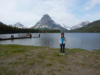
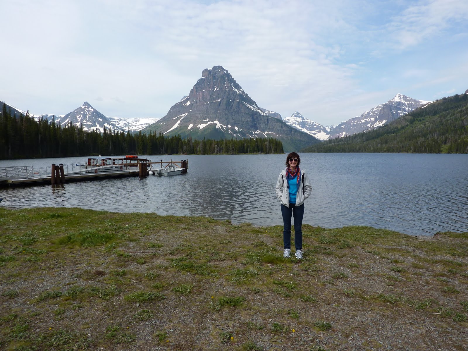
all told. and what a drive. we covered everything from mountains to plains and back again. we spent the night at a sub-par motel called the dancing bear inn in a town called east glacier park, though not in the park itself. on sunday morning we woke up fairly early and drove into the park for the first time. we went to an area called two medicine, named for the three lakes: lower two medicine, two medicine, and upper two medicine. they got their names (we later learned from ranger lynn; that's her on the right) because a tribe of blackfeet from the east side of the park and a tribe from canada accidently set up their camps on opposite sides of the lake. they took this as a good sign, and combined their camps--medicine is their word representing power and luck. hence, two medicine. that day we were going to take a boat across two medicine lake and then hike up to upper two medicine lake. well, we started out well enough--the boat ride was awesome, with ranger lynn giving commentary about the mountains and their names, etc. once we crossed the lake, we set out

to hike, first to twin falls, which is pictured at the left. we hypothesized that at one time the falls fell down the middle and at some point it diverted itself. anyway, the creeks, rivers and lakes at glacier are beautiful because, as you can kind of see in this picture, the stones are these beautiful shades of grey, red, and turquoise. and with the water running over them, they are almost jewel-toned.after spending a little time at the twin falls looking for american dipper birds (i kid you not) we continued on our way up to the upper lake. on the way, lynn was pointing out wild flowers, such as these beautiful glacier lilies, explaining things about grizzly bears, t

elling indian stories and various other interesting tidbits. after a couple of hours we reached this beautiful sub-alpine meadow that lynn is standing in above. in the midst of these glacial mountains and giant forests, this beautiful meadow filled with grasses and small trees, lots of wildflowers. apparently it is what is known as an avalanche chute--an avalanche will fall, taking everything with it except the trees so small they are below the snow line (which isn't even really that small). these meadows are what is left. the picture directly below was taken facing back to the east toward two medicine lake--it shows how the glaciers carve mountains really well. they leave behind a bowl shape--a u-shaped bottom and steep sides.


finally, finally, after another hour, we reached our destination. but only after climbing up a snow bank several feet high. (there's your snowball, aunt b). this lake was even more beautiful in person that it seems in the picture. the blotch in the center of the water is ice--it still covered the center of the lake. it was also flooded: they had a lot of rain that spring (and by that i mean june), so the lake was flooded. directly below the edge of this picture are logs which are normally seating for hikers such as ourselves, but they were practically underwater. it was one of those moments, you know, when you really only see how wonderful and beautiful this world can be.

after lunch by the lake, ke

eping a lookout for grizzly bears, we hiked back to two medicine lake and took a boat back to the other side. by this point it was starting to cloud over, but mind you, they said that it was going to rain all day, so we were actually quite lucky. we headed out of the two medicine area and went north to the going-to-the-sun road, entering the park again at st. mary. this road was amazing! it was finished in 1932, and is itself a national historic landmark. we stopped periodically at places like this breath-takingly beautiful river-carved gorge. and at the goose island overlook, one of the most photographed spots in the park,

just below this paragraph. we also saw our first glacier--jackson glacier! for those interested, being a glacier is actually hard work--namely, it has to be moving, in addition to being a certain size (which i am currently forgetting). when they saw that the glacier are disappearing, they usually mean that they are turning into what they call permanent snow fields: snow that is there permanently and doesn't move, which makes it not a glacier. anyway, that's the glacier to the right, in case you wanted to see it.

we had to turn around at the jackson glacier overlook--we heard tell that in the process of plowing the road they found a landslide, and it was understandably slowing down the process. by the time we returned to st. mary and settled down for dinner at the delicious park cafe, it was hailing. really really. while i worried for my car, it was only pea-sized, and i returned to my indescribably delicious boysenberry pie (they were out of huckleberry cream). we then slowly returned to east glacier park through the rain and hail, and slept very well that night, having hiked about 9 miles.


 on monday it was supposed to rain. all day. so we decided to forsake a second day of hiking in glacier and instead decided to drive north to the waterton lakes national park side of the international peace park. it was pretty neat! we actually crossed the border inside the park, crossing over into alberta. of course, much of what we saw was like the picture at the top of this post--mountains poking out occasionally from clouds. we drove into waterton lakes park via an indian reservation, got there, went to information, and then headed directly for the prince of
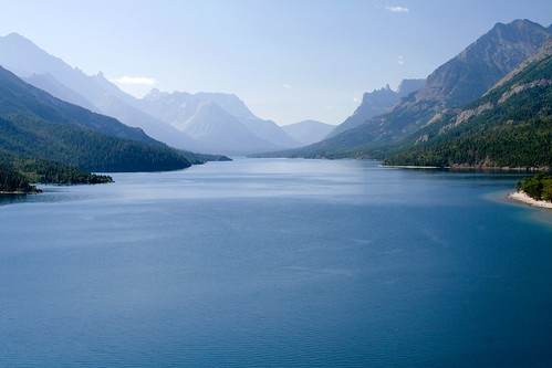
  wales hotel. this beautiful hotel is located on a hill overlooking one of the main lakes in the park--stunning from a distance, and quite gentrified up close. it was even beautiful on the inside, all open spaces with huge windows overlooking the lake. we went in and had a delicious lunch, peering out the window through the rain. after lunch it was still drizzling, and we didn't have the energy to do much other than leave the park--we still had a full day of driving ahead of us. below is the view over the lake from the hotel, although in the sunlight it looks like this.

 carry 2,000,000 tennis balls and is called a titan 38-19. by then the sun had begun to come out and we could really see the mountains around us. they were absolutely beautiful. it's different out here--i mean, i know the mountains are bigger, and more untouched, but it's more than that somehow. anyway, both southern alberta and southeastern bc were stunning. and had very expensive but well-regulated gas. we crossed from bc into idaho, which is filled with mountains and lakes in the northern panhandle (which should have gone to montana, incidentally). we came down the panhandle of idaho, crossing the border into washington state and headed to spokane, where we spent a couple of days relaxing and recovering from sports camp, hiking, and driving. as well as doing laundry, planning ahead, etc. the pic below was taken in bc.


